Malta beaches by bus
Nine beaches, three islands, one honest answer for each: whether a bus gets you there in any practical sense, what changing onto a ferry or a second leg costs you in time, and what the walk looks like once the bus has done all it can do.
What this page gives you instead of a route number
No route numbers, departure times, fares or frequencies appear anywhere here, on purpose. Those change without notice, and a stale one strands somebody at a stop on what should have been the easy part of the day. What you get instead is the judgement a timetable cannot give you: whether each beach sits somewhere a bus genuinely reaches, and what the trip costs you beyond the ride itself.
At a glance
Nine beaches, one verdict each, before any of the reasoning behind it. Tap a card to jump to the full case for that beach further down this page; nothing there leaves a word out.
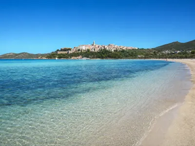 Bus reaches it
Mellieħa Bay
A big sand beach beside a proper town, the easiest case on this list.
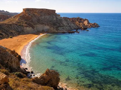 Bus, then maybe a walk
Golden Bay & Għajn Tuffieħa
Golden Bay's an easy walk in. Its neighbour next door means a flight of steps.
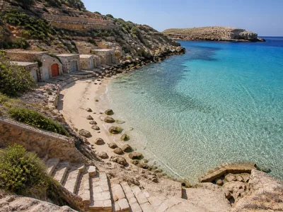 Bus, then a short walk
Paradise Bay
Close to the ferry terminal, then a flight of steps down to the cove.
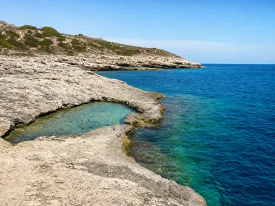 Bus, then a longer walk
St Peter's Pool
No shade and nothing to buy along a real stretch of coastal walking.
 Ferry first
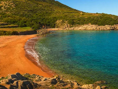
Ramla Bay, Gozo
Gozo by sea, then a flat, forgiving approach once you have landed.
 Ferry, then a climb
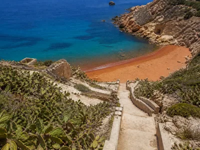
San Blas Bay, Gozo
Gozo by sea, then a steep lane on foot down to the sand.
 No bus, boat only
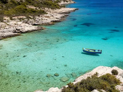
Blue Lagoon, Comino
Comino carries no road traffic at all. A boat is the only way across.
 No bus, boat only
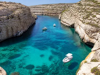
Crystal Lagoon, Comino
Same island, same answer: every visitor arrives here by boat.
 Not without a car
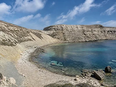
Fomm ir-Riħ
Well clear of the resort coast, with no service that gets meaningfully near.
The three questions that actually matter
A route number answers one narrow question. These three answer the one you actually care about: whether going without a car is a sensible plan for the beach you have in mind.
First, is this the kind of beach a bus network exists to serve, a big sand bay beside a town, or somewhere the network was never going to reach on its own terms? Second, does getting to the water involve a further step once the bus has done what it can do: a ferry, a long walk, or a genuine descent? Third, realistically, how much of a day does the round trip cost against how much of it you actually get to spend swimming? Everything below answers those three questions for each beach on this site, in place of a number we would not stand behind.
Reached by an ordinary bus journey
Mellieħa Bay is the clearest case on this list. It is a large sand beach beside a proper town, and a beach in that position is exactly the sort of destination a public network is built around rather than merely permitted to reach. The walk from wherever a service sets you down to the sand is short, the way a walk from a stop to a beach beside a town generally is, and the round trip costs you very little of the day beyond the journey itself.
Golden Bay sits in similar company, on a stretch of coast served well enough that arriving without a car is entirely ordinary. The caveat belongs to its neighbour rather than to Golden Bay itself: reach the same car park and choose Għajn Tuffieħa instead, and the last stretch to the sand is a long flight of steps down, covered properly on that guide. Treat Golden Bay as the easy half of that pairing, and its neighbour as the next section below.
A bus gets you close; the rest is on foot
Għajn Tuffieħa belongs in this tier rather than the one above, because the bus and the beach are separated by a real descent that has nothing to do with any timetable. However good the service is, the last stretch of the journey is on foot and downhill, and the return leg is uphill at the end of a hot day. Budget that stretch as its own piece of the trip rather than an extension of the ride.
Paradise Bay sits in the same tier for a different reason. It is close to the Ċirkewwa ferry terminal, itself a destination a network reaches because people travel to it for the crossing, so getting to that corner of the island is not the hard part. What follows the bus is a flight of steps down to the cove, short enough not to put most people off but real enough to plan for rather than assume away.
St Peter's Pool is the harder version of the same shape. It lies out past Marsaxlokk with nothing built at the water's edge, so whichever direction you arrive from, a stretch of coastal walking with no shade and nothing to buy along it separates the road from the rock shelf where the swimming actually happens. Carry water and shade for that stretch regardless of how you get to Marsaxlokk itself.
The ferry comes first: Gozo's two
Both of Gozo's beaches on this site need the sea crossing before they need any road at all, so the honest way to plan either is as a ferry day with a beach folded into it, rather than a beach day with a ferry attached. Budget the crossing, the wait either side of it, and Gozo's own onward network as the largest part of what this costs you, not as a formality before the part that counts.
Ramla Bay is the more forgiving of the two once you are actually on Gozo, because the approach ends at sea level and stacks no descent on top of the crossing. San Blas Bay adds one, a steep lane on foot at the end of the onward journey, worth weighing seriously if the return leg of an already long day is going to be tight. Either way, settle your return sailing before you settle anything else, because missing it costs a great deal more than missing a bus ever does.
No bus reaches these at all
The Blue Lagoon and Crystal Lagoon both sit on Comino, an island with no road vehicles and barely a handful of permanent residents, so a bus is not a limited option here, it is not an option in any form. Getting to either one means a boat, departing from the Malta side at Ċirkewwa or Mellieħa, or from Mġarr over on Gozo, and that crossing replaces the entire question this page is otherwise trying to answer. Build the day around the sailing, not around a stop.
The one we would not attempt without a car
Fomm ir-Riħ is the one entry on this list where dressing up public transport as a realistic plan would be dishonest. Reaching it means leaving the resort coast behind entirely and driving to the head of a footpath that finishes in a rough scramble down, and no service we could responsibly point you toward gets meaningfully nearer than a car already does. Without one, this is a beach for a different trip rather than one worth improvising around.
Parking, if a car is part of the plan
Not every trip on this list is a bus trip, so a word on the alternative before the final checklist. We are going to say less about parking than most pages do: we have not sourced a capacity or a charge for a single car park on this list, and guessing at either would be worse than leaving the gap open. What is worth planning around instead is the pattern rather than a number. The popular bays fill their car park before they fill their sand, the season runs roughly May to September, and arriving in the middle of a July afternoon is that problem with no good outcome left. Going early fixes the parking and the crowding in the same move, which is the same advice the descents above already give you for a different reason.
What to confirm before you rely on any of this
Confirm three things with Malta Public Transport before any beach day on this list depends on a bus: that a service genuinely reaches the point closest to the beach on the day you are travelling, what the last realistic departure back actually is, and whether anything about the route has changed since this page was last checked. None of the three survive being answered once, months ago, by a website. All three take a few minutes to check on the day and cost nothing to get right.
Where a ferry is involved, hold the crossing to the same standard. Sailings move with the season and with the weather far more than a road service does, so check the sailing for the day you travel.
Common questions
Which Malta beaches can you reach by bus alone?
Mellieħa Bay and Golden Bay stand out as the two best examples: sizeable sand beaches next to a proper town, which is precisely the kind of destination a public network gets built around. Check the live timetable for the day you travel.
Why doesn't this page give route numbers?
Because those figures shift without warning, and getting one wrong leaves a reader stuck somewhere a service used to call. Instead this page judges which beaches a network is genuinely built to reach and which are not, a question the live timetable cannot answer for you.
Can you reach the Blue Lagoon or Crystal Lagoon by bus?
No, not for any part of the trip. The island itself carries no road traffic and only a handful of people live there year round, so a boat stands in for the bus completely on both of these lagoons.
Do Ramla Bay and San Blas Bay need a car?
They need a ferry before either needs a car, since both are on Gozo. San Blas adds a steep descent on top of that crossing, while Ramla's approach ends at sea level once you're on the island.
Is Fomm ir-Riħ reachable without a car?
Not in any sense we would stand behind. It lies well clear of Malta's towns and resorts, and getting close means driving to a footpath that then drops steeply on its own. Plan on a car for this particular beach.
What should you check before relying on a bus for a beach day?
Three things, checked on the day rather than assumed from a page like this one: that a service still runs to the point nearest your beach, what time the last one back actually leaves, and whether anything on the route has moved since you last looked.
Last checked: 15 September 2026. Bus and ferry networks both change without notice, so treat every judgement above as a starting point rather than a booking. You will find no route number, departure time, fare or frequency anywhere on this page, because none of the four would still be reliable by the time you read it.